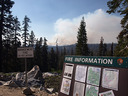
山火事のためクローズとなっていたBig Oak Flat Roadは9月8日(火)午後5時から、通行可能となりました。Tioga Roadの通行規制も解除されています。
—
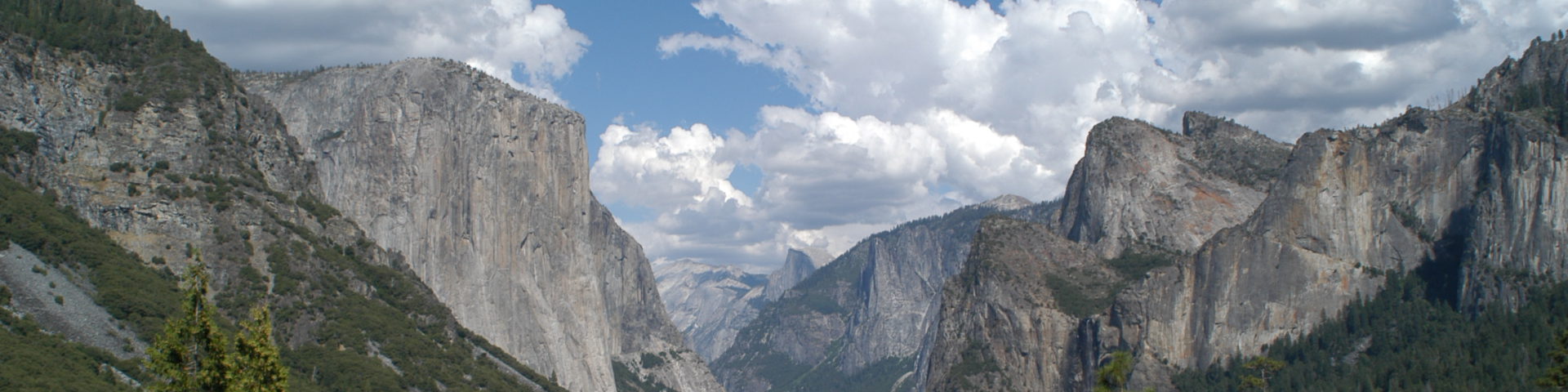
Yosemite National Park to Re-Open Big Oak Flat Road at 5:00pm Tuesday, Sept
Yosemite National Park Acting Superintendent Dave Uberuaga announces that Big Oak Flat Road from Crane Flat to the El Portal Road will re-open at 5:00pm Tuesday, September 8.
http://inciweb.org/incident/1869/
投稿者アーカイブ: toshi
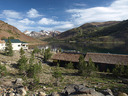
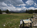
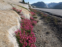
ヨセミテ 8月1日
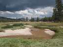
さすがに水量が減り始めたBudd Creek。
草原にはかなり茶色の草が目立つようになリました。
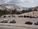
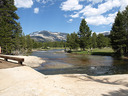
かなり賑わっていたOlmsted Point。
ヨセミテ 7月18日
ヨセミテ国立公園内ではありませんが、すぐ横20 Lakes Basinへの玄関口、Saddlebag Lake南岸のWater Taxi乗り場。
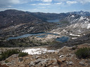
20Lakes Basin。
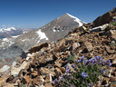
左手前はSteelhead Lake、その右側はCascade Lake。奥はSaddlebag Lake。
右奥の山はMt. Dana。ワイルドフラワーは今がピークのようでした。
Cascade Lake沿いから見るNorth Peak北壁。左奥の稜線はMt. Connessの東稜。
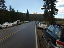
Tioga Road沿いCathedral LakesへのTH。いつものように車が一杯。突然の雨に走るハイカー。
すぐ傍にある、バス停に車を停めないようにしましょう。レッカー移動されます。
すぐ西のPothole Dome付近では、パラパラと雨が降っただけでした。
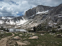
ヨセミテ 7月11日
Gaylor Lake(Lower, 10,049ft.)へ向かうトレイル。周辺の草原の緑が綺麗です(蚊も多い)。右奥はGaylor Peak。
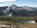
Granite Lake(手前、標高10,392ft.)とGaylor Lake(奥、標高10,510ft.)。手前の小さな山はGaylor Peak。
奥はもちろんMt. Dana。
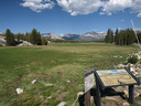
火事の煙もなくクリアな空が広がったTuolumne Meadows。

Olmsted Pt.は花がピーク。
エルニーニョ発生、
今年の冬はウエットになる可能性があります。
NOAA expects this El Niño to continue developing during the next several months, with further strengthening possible. The event is expected to last through winter 2009-10.
:
El Niño’s negative impacts have included damaging winter storms in California and increased storminess across the southern United States. Some past El Niños have also produced severe flooding and mudslides in Central and South America, and drought in Indonesia.
NOAA News
過去のデータ解析
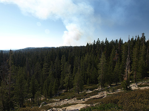
Grouse/Harden Fires : 火勢はかなり衰えたようです
Fire Update #21
July 8, 2009
Activity on the Grouse and Harden fires in Yosemite National Park has slowed significantly with
the fires reaching the established boundaries that managers planned for the incidents. The
Grouse Fire is three miles southwest of Yosemite Valley and north of Glacier Point Road. The
Grouse Fire is 3,029 acres and 93 percent contained. The Harden Fire on the north side of the
park, west of Harden Lake and northwest of White Wolf is currently 1,661 acres and 95 percent
contained.
Webcamによる観察だけですが、此処1?2日で、Valleyに入り込む煙がかなり減りました。
ヨセミテ 7月4日
Pride of the Mountainが咲き始まったOlmsted Point(朝)
Sky Pilotはまだ4分咲き。花が丸くなっていません。
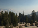
Tuolumne Meadows:午後になると、火事の煙がかなり入り込んできました。
Olmsted PointからみるClouds Rest、Half Dome(午後おそく)。
White Wolfの近くで。
その他:
Tuolumne Meadows CG、Yosemite CreekCGにはFullのサインが出ていました。
火事の煙により、Tioga RoadのWhite Wolf東側はかなり視界が悪くなっていました(今日の午後から)。
10,000~11,000ft.付近では、ワイルドフラワーが咲き始まりました。
火事
Harden Lake, Smith Meadow, and Pate Valley Trails are closed due to fire activity in the area (A. Rothell, 7/1/09).
先週末27日の煙。Tioga RoadとWhite Wolf Rdの交差点より西側数百メート地点より撮影(White Wolfの道標のあるところで、道路北側に広い路肩あり)。
Harden (37 53.624 x 119 42.221; 7800’, Tuolumne Co); Lightning-caused, probably on June 8. It is north of White Wolf, west of Harden Lake and within the 1996 Ackerson fire perimeter. It is 220 acres and burning mostly in brush and Red Fir. Fire officials are assessing the need for closures around Harden Lake, Smith Peak and the old Aspen Valley Rd.
Yosemite Valley付近にもかなりの煙が入っています。Turtleback Dome
Grouse (37 41.445 x 119 41.017; 6500’, Mariposa Co.), started May 30. It is approximately 350 acres. Personnel are working ahead of the fire implementing management actions along Steamboat Ridge to prevent northward fire spread. The fire is visible along Wawona Road (Highway 41) and Glacier Pt. Road. Please expect temporary road delays near the fire vicinity.
Yosemite Creek &, Porcupine Flat CG Open
Yosemite Creek, Porcupine Flat, and the A-loop of Bridalveil Creek Campground (including group and horse sites) are open for the season today. (M. Carter, 7/1/09)
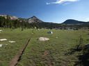
ヨセミテ 6月27日
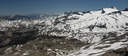
Tuolumne Riverの主流が流れるLyell Canyonの最奥部。Donohue Passは左から二つ目の鞍部付近。左斜め下の黒い部分(樹林帯)はLyell Canyon、右側最高峰がMt. Lyell(13,114ft.)。尾根の裏側はSan Joaquin水系。
Lyell Canyonの前半部(下流側)。奥の山々はMt. Conness(一番高い)、White Mountainなど。右の尾根はKuna Crest。
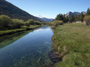
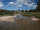
Tuolumne River(Lyell Fork)の上流方面を望む。 TMのCGからは約3マイル地点。Mt. Lyellが見える地点まではさらに3マイルほど進む必要があります。
Tuolumne River(Lyell Fork)に架かる橋。Tuolumne Meadows Lodgeの南0.5マイル付近。奥の山はMammoth Peak。
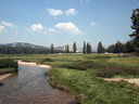
もう夏の雰囲気のTuolumne Meadows。