シャットダウンはなかなか辛い状況ですね。
サンフランシスコ・クロニコル紙の記事2本
Forging on: My vacation in a closed national park
Yosemite’s grandeur dimmed by politics
シャットダウン
10月1日から全米の国立公園・国立史跡等の国立公園局管理箇所がクローズされました。
これは連邦議会におけるオバマ大統領のヘルスケア法に関する長期間にわたる論争によって、暫定予算法案の成立が遅らせられたことによります。
これによって、一部の政府機関の職員が出勤停止になり、一時閉鎖になっています。
クローズはもちろんヨセミテ国立公園も例外ではありません。
また、国立公園局のWEBサイトもクローズしています。
http://www.nps.gov/shutdown/index.html
いつまで続くかは不明です。
一刻も早い再開を望みます。
Hiking Halfdome
ハーフドームへのハイキングコースを紹介します。
Strenuous Yosemite Valley Day Hikes
ヨセミテヴァレーのやや健脚向けのデイ・ハイキングコース
1.ミストトレイル
2.パノラマトレイル
3.アッパーヨセミテフォールトレイル
が紹介されます。
Easy Yosemite Valley Day Hikes
Youtube動画で、レンジャーのシェルトン・ジョンソンが案内するヨセミテヴァレーのデイハイキングです。
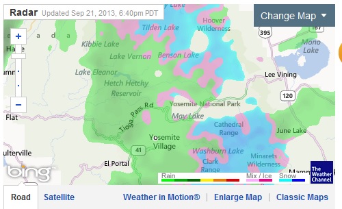
CA 120 (Tioga Rd), CA 108 雪のため閉鎖
今日ベイエリアには雨がかなり降りました。前線はセントラルバレーを越えてシエラの山に移動、現在Tioga Rdは雪のためクローズしています(一時的ですが)。 Rim Fireの沈静化にはかなり貢献しそうです。Web CamではValleyは雨。
Current Situation
Total Personnel 1,321
Size 256,895 acres
Percent Contained 84%
Estimated Containment Date Tuesday October 01st, 2013 approx. 12:00 AM
SR 120
[IN THE CENTRAL CALIFORNIA AREA & SIERRA NEVADA]
IS CLOSED FROM CRANE FLAT TO 12 MI WEST OF THE JCT OF US 395 /TIOGA PASS/
(TUOLUMNE, MONO CO) – DUE TO SNOW – MOTORISTS ARE ADVISED TO USE AN ALTERNATE
ROUTE
R 108
[IN THE CENTRAL CALIFORNIA AREA & SIERRA NEVADA]
IS CLOSED FROM 7.2 MI EAST OF STRAWBERRY TO 5.3 MI WEST OF THE
JCT OF US 395 /SONORA PASS/ (TUOLUMNE,MONO CO) AT 1730 HRS ON 9/21/13
– DUE TO SNOW – MOTORISTS ARE ADVISED TO USE AN ALTERNATE ROUTE
CA120 – Tioga Rd.
White Wolfまで道路沿いの様子を見に行ってきました。
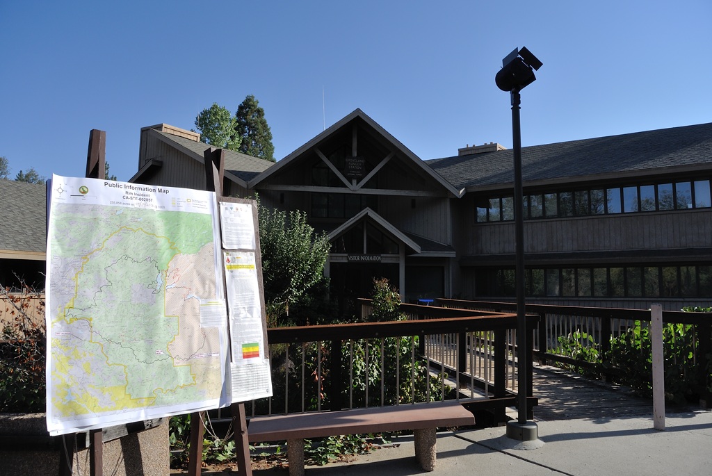
Groveland Forest Service ranger station。
この建物の裏側を120号が走っています(左が西側)。120号の北側にはすぐTuolumneの谷があり、対岸の尾根から今回の大火事が発生。ここから先、道路沿いに火事の焼け跡が見え始まりました。
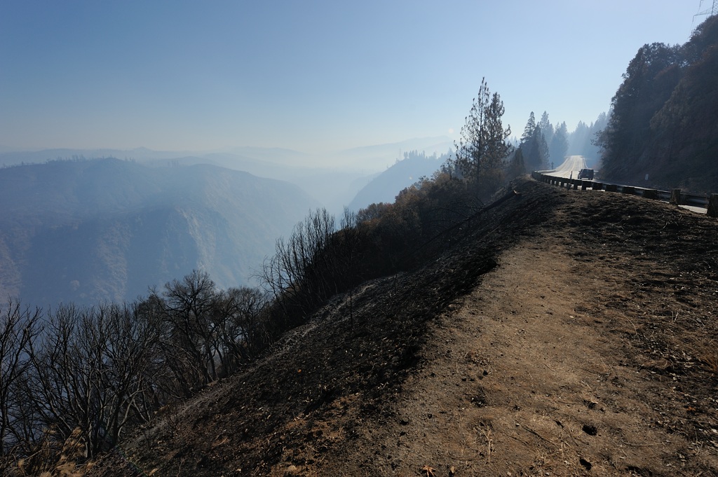
Ranger Stationを過ぎて5分ほど走るとBuck Meadowsに到着、ここには、道路沿いにキャビン、Yosemite West Gateモーテル、レストランなどがあります。周辺の林は焼けていましたが、建造物などに被害は見られませんでした。写真はBuck Meadowsのすぐ東にあるVista Point。このあたりから、South fork Tuolumneの橋(ヨセミテ公園に入る前の最後のgas station, Harden Flat, から数マイル先)の間の被害が一番ひどいようでした。まだ朝なので逆光のためかなり視界が落ちます。
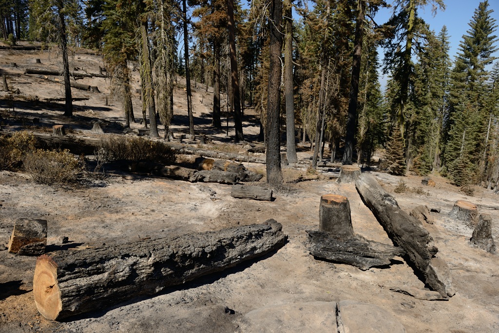
Gin Flat付近の焼けた斜面。
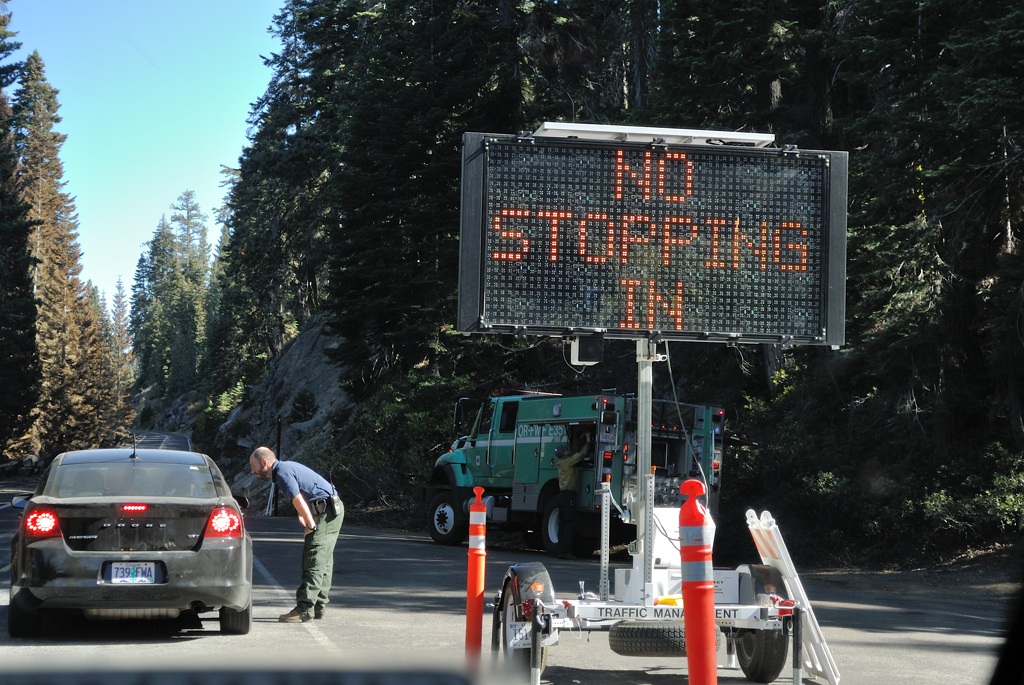
Tioga Road, T5マーカー地点: 停止サインがあり、ここから先は25マイル規制で、駐車は禁止。
地図を見ただけではどのように焼けたのか想像がつきませんでしたが、公園内は、一部道路沿いに火事の跡が見られたものの、いつもの夏の景色とあまり変わりませんでした。気づいたことを書き並べると:
*Grovelandと公園入り口の間は煙かった。
*公園内で煙の影響はまったくなかった。
*エントランスの周りは一部地面が焼けていたが、あまり変化なし。
*Tuolumne Groveへの立ち入りは禁止、Merced GroveはOK。
*Gin Flat付近からT6マーカーまでの間、道路北側に所々火事の跡が見えた。
*T5からSiesta Lake・White Wolfのは完全停車禁止
* White Wolf入り口のサインには、”full”となったままだった。
*かなりの数の消防関係の車とすれ違った。
Tioga Rd 開通
Special Road Update
Tioga Pass Road (Hwy 120 east) across Yosemite National Park to Tuolumne Meadows and Lee Vining (Hwy 395) opened at noon today. For safety visitors are not permitted to stop along the road adjacent to the fire perimeter.
http://inciweb.nwcg.gov/incident/3660
http://www.dot.ca.gov/cgi-bin/roads.cgi
RIM FIRE
Current Situation
Total Personnel 2,170
Size 255,858 acres
Percent Contained 80%
Estimated Containment Date Friday September 20th, 2013 approx. 12:00 AM
Significant Events
Approximately 9 miles of fire perimeter in the eastern area of the fire and within Yosemite National Park has been declared contained.
White Wolfそばの包囲線が広がっています。
RIM FIRE
東端のRRRRのラインがTioga RoadからWhite Wolfeへの道路。White WolfeからHarden LakeまでHHHHは林道(Old Tioga Roadの一部)。Harden LakeからTuolumne渓谷のリムまではトレイル。ここが防衛線のようです。
Road Openings
Evergreen Road is opened to Evergreen Lodge. State Hwy 120 is open to Crane Flat. The Big Oak Flat Road is open. Businesses are open and providing services (gasoline food and lodging) for travelers.
Current Situation
Total Personnel 2,764
Size 255,560 acres
Percent Contained 80%
Estimated Containment Date Friday September 20th, 2013 approx. 12:00 AM
http://inciweb.nwcg.gov/incident/3660
