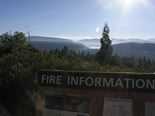
Laurel Fireはほぼ鎮火したようで、ヨセミテ北西部には快晴の空が戻ってきました。7月末、3週間前と比較してみてください。ちょっと逆光気味ですね。
月: 2006年9月
A Rival of Yosemite: 1891年6月

Muirの歩いたシエラネバダ(続き)
1891年5月28日、Muirは画家のRobinsonと共にSan Franciscoを出発し、Kings渓谷と出来たばかりのGeneral Grant及びSequoia National Parkへと向かいます。これは1873年10月、1875年7月、そして1877年10月の旅行に続き、Muirにとって4度目の訪問となります。日記[1]によると、5月30日にGeneral Grant National Parkを訪ね、6月1日にはKings渓谷へと下り、そこで2週間近くをすごしています。Robinsonと共に渓谷沿いの岩山(Second Sentinel)に登ったこと、出会った少年が熊をしとめた話、帰るときに増水した川にミュールが落ち、それを助けたことなどのエピソードが書かれています。Muirは渓谷の様子について克明な記述を残しており、そこがヨセミテ渓谷とかなり似た形状をしていると書いています[2]。MuirはここでYosemiteという言葉をヨセミテ渓谷のような形状の谷と一般化し、The Kings River Yosemiteと使っています。
さてMuirは同年11月、Century誌に”A Rival of Yosemite: The Canyon of the South Fork of King’s River, California”[2]という記事を掲載します。これはKings渓谷の概略、アプローチ、渓谷景観の詳細な記述、過去4回の自分の探査行などをRobinsonの描いたスケッチと共にまとめたものです。78ページ目(記事の第2ページ)には、出来たばかりのSequoia National Parkの地図があり、そこにKings渓谷を含む広大な一帯を追加する提案がされています[3]。日記と”A Rival of Yosemite”を読み比べると、後者ではかなり自然保護を訴えていることに気づきます。また日記では淡々と書きとめた熊狩りの話ですが、動物愛護風の書き方に変わっています。
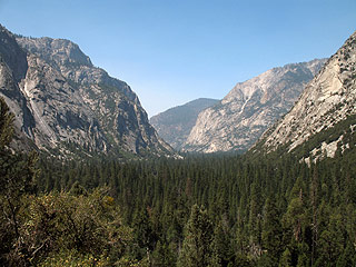
写真:Kings渓谷の上半分を上流から望む。
参考:
[1]”John of the Mountains: Unpublished Journals of John Muir”(Linnie Marsh Wolfe編)
[2]6月1日のエントリーは、渓谷の様子について詳しく書いています。しかしWolfeは脚注で、オリジナルの日記が判読不明なためCentry誌の記事を使って代用したと書いています。注意して読み比べると、数行を除いて完全なコピーとなっています。
[3]”Remembered Yesterdays”(Robert Underwood Johnson著)によると、1891年5月にJohnsonは、Muirに依頼して作らせたKings渓谷付近の地図を内務省長官Nobleに送り、その一帯を保護区とするように提案しています。Muirは常日ごろ、ヨセミテ渓谷よりKings渓谷のほうがよりすばらしいと主張していたとの事です。 ”May, 1891, I sent him a sketch map which at my request Muir had made of the Kings’s River Canyon region to support my proposal that a large reservation should be made to include that gorge, which Muir always asserted was more wonderful than the Yosemite.” これにNobleは8月28日に返信し、Kings渓谷をSequoia NPに組み込む件は、機会があったら大統領に尋ねてみると返答しています。 ”It will greatly please me to bring the additional reservation for the Sequoia National Park before the President as soon as an opportunity is afforded. The necessary legislation will also be asked.”
140号 常時開通
Highway 140 Ferguson Rock Slide Bypass Open 24 Hours A Day
(Mariposa County) The Department of Transportation (Caltrans) is opening Highway 140 to 24 hour traffic. Beginning September 1, 2006 the two bridge temporary bypass installed to move motorists around the rock slide will be open to one-way controlled traffic 24 hours a day.
Due to roadway restrictions, vehicles over 28 feet in length are not allowed on the bypass. The oneway bypass will be controlled by traffic signals. ### (B. Boswell, CALTRANS – 9/1/06)
Camp4−El Capitan間のシャトルサービス
Camp4からEl Campitanの麓までのシャトルサービスがあるようですね。地図には出ていないそうです。
The El Capitan Shuttle is now stopping at Camp 4 so that it can be more useable to the many climbers who stay at this campground. This stop is on the north side of North Side Drive near the old gas station area, not at the Valley Shuttle Camp 4 stop. The new stop does not show up on the maps yet, so it will be up to all of us to get the word out to visitors, especially those staying at Camp 4. Shuttles operate daily from 9 am to 6 pm, leaving every hour and half hour from the Visitor’s Center and will arrive at Camp 4 shortly after the hour and half hour. The last bus leaves the Visitor Center at 6 pm.
Since this service has been well used and the El Capitan climbing area is very popular in September, the El Capitan Shuttle has been extended through the 1st of October. It is hoped that the addition of the Camp 4 stop and the extension of service will benefit visitors as well as reduce the number of vehicles parked at the El Capitan area. Further extension to this service will be considered if ridership remains high through September. (W. Malone – 8/31/06)
